Hiking markers and signs | French Hiking Federation
écrit par Marion BRISHiking trails are marked with clearly defined signs of various shapes and colors, making it easy for hikers to find their way. This system was implemented in 1947 with the creation of the first long-distance hiking trails (GR®) under the impetus of the National Committee for Long-Distance Hiking Trails, now FFRandonnée.
Symbols to guide hikers
Each marker has a specific meaning:
- Two horizontal lines (only one for PR routes) indicate you are on the right path.
- An oblique arrow accompanied by these lines announces a change of direction, with the arrow indicating the direction to follow.
- A cross formed by two lines means the path is incorrect and should not be taken.
These indications are universal, regardless of the type of trail.
A distinction by color
To differentiate route types, a color code is used:
- White and red: GR® (Grande Randonnée), multi-day or multi-week routes.
- Yellow and red: GR® de Pays, circuits exploring a specific region in connection with its heritage.
- Yellow: PR (Promenade et Randonnée), for day walks.
Although this classification is generally followed, some regions still have their own codes for PRs.
Standardized signage
Markers measure 10 x 2 cm, a standardized size to avoid confusion with other markings. They are generally spaced 150 meters apart, especially at intersections, but this distance can vary depending on the terrain and orientation needs. Depending on the surface, they can be painted, self-adhesive, or fixed on plates.
Understanding hiking trail signage
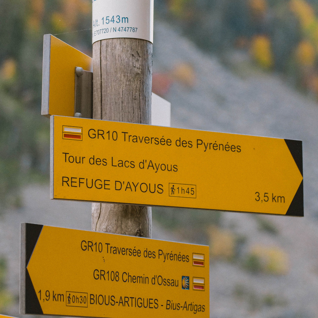
Hiking trail intersections are often equipped with directional signs, indicating main destinations and routes to follow. These signs generally comply with standardized marking codes: GR® are identifiable by white and red indications, sometimes accompanied by their number when they intersect with other routes.
These signs also include valuable information such as your current location, altitude (marked at the top of the sign), and estimated distances and walking times to various points of interest.
Varied markings depending on the paths
Although FFRandonnée and its volunteers strive to standardize signage, regional variations still exist. Some trails retain old markings or more atypical signage.
Historical and Way of St. James trails
Some iconic routes have specific signage, often linked to their history. This is the case for the Stevenson Trail, the Saint-Guilhem Trail, the Via Francigena, and the Urban V Trail.
The paths leading to Santiago de Compostela have their own signage, but this can vary by region. The European standard provides for a stylized yellow shell on a blue background indicating presence on the correct path. However, some regions use it to indicate direction, sometimes reversing the original meaning. In Spain, it is common for the shell and its rays to indicate the way to follow, while in other places, it is the tip of the shell that acts as a directional arrow.
In addition, various symbols such as yellow arrows, ground markings, or even stylized pilgrim silhouettes mark these routes. Despite these differences, the risk of getting lost remains low, because in France, these paths often use GR® routes, whose marking is standardized.
Local and European markings
In addition to official markers, some areas have developed their own signage:
- The blue markers of the friends of the Fontainebleau forest,
- The three red dots marking for secondary trails in the Calanques of Marseille,
- The characteristic green rectangle of the Vosges Club in the Vosges massif.
You may also encounter European markers: signs bearing an E followed by a number, surrounded by the European flag. These indications are still rare and are mainly found at major intersections of European hiking trails, which largely follow the GR® routes crossing France.
Beware of marking "false friends"
Not all markings on trails necessarily concern pedestrian hiking. Other types of routes have their own signage:
- Mountain biking and cycling: recognizable by their round and triangular markers,
- Equestrian hiking: often orange markers, visually similar to those of PR®.
There are also forest markings that can be confusing. Some are painted on trees in red, and can resemble GR® indications. In particular, the municipal boundary marker, consisting of red and white, is wider than classic markers and has a central red line framed by two white lines.
Last piece of advice before you go 🚴🏻♀️
If you no longer see the markers corresponding to your route, do not continue at random. Retrace your steps to the last marker encountered. In the absence of visible marking, an IGN map or a GPS will help you find your way safely.


